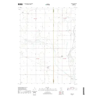
2019 Map of London
USGS Topo · Published 2019About this map
London sits at the heart of this agricultural landscape in southern Minnesota, situated near the border between Freeborn and Mower Counties. The settlement patterns here are defined by a strictly organized grid of county highways and township roads, such as Co Hwy 34 and 110th St, which intersect at regular intervals across the fertile plains. For genealogists, the map is remarkably dense with family-named and local burial sites, including the Kennevan Family Cem, London Cem, and Deer Creek Cem.
Find a feature on this map
51 named features on this map. Tap any name to fly to it.
Don’t see what you’re looking for? This feature index may not catch every label — zoom into the map to look around manually.
Map Details
Editions of this 2019 London Map
This is the sole edition of this map. No revisions or reprints were ever made.
Other maps of this area

1954 · Hayward
USGS Topo · 1:62,500

1954 · Austin
USGS Topo · 1:62,500

1954 · Mason City
USGS Topo · 1:250,000

1957 · Mason City
USGS Topo · 1:250,000

1958 · Mason City
USGS Topo · 1:250,000

1972 · St. Ansgar
USGS Topo · 1:24,000

1972 · Northwood
USGS Topo · 1:24,000
1972 · Carpenter
USGS Topo · 1:24,000
1982 · Austin East
USGS Topo · 1:24,000

1982 · Hayward
USGS Topo · 1:24,000