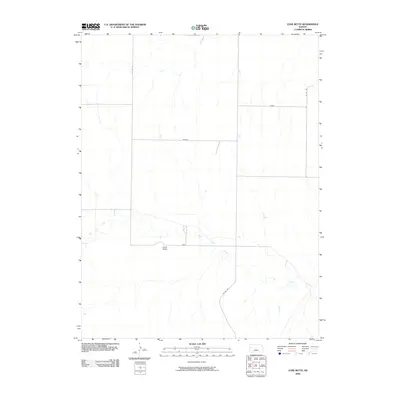
2009 Map of Lone Butte
USGS Topo · Published 2009About this map
Lone Butte serves as a prominent landmark in this Logan County landscape, situated just north of the winding course of Twin Butte Creek. The area is defined by a sparse but organized network of roads that follow the section lines of the Public Land Survey System, including Gold and Jayhawk. These named roads, alongside Kiowa, suggest a history of rural property divisions and local connectivity in the high plains. The drainage patterns of the creek and its small tributaries illustrate the subtle topography of the region, where water management and road placement were essential to the development of the local ranching or agricultural economy. This 2009 survey by the U.S. Geological Survey provides a detailed record of these essential arteries, such as Co Rd 240 and Co Rd 270, which facilitate movement across the open prairie.
Find a feature on this map
8 named features on this map. Tap any name to fly to it.
Don’t see what you’re looking for? This feature index may not catch every label — zoom into the map to look around manually.
Map Details
Editions of this 2009 Lone Butte Map
This is the sole edition of this map. No revisions or reprints were ever made.
Other maps of this area

1939 · Pence
USGS Topo · 1:62,500

1941 · Pence
USGS Topo · 1:62,500

1955 · Scott City
USGS Topo · 1:250,000

1958 · Scott City
USGS Topo · 1:250,000

1968 · Russell Springs 3 NE
USGS Topo · 1:24,000

1969 · Russell Springs 2 NE
USGS Topo · 1:24,000

1969 · Russell Springs 2 SE
USGS Topo · 1:24,000

1972 · Russell Springs
USGS Topo · 1:24,000
1972 · Russell Springs NE
USGS Topo · 1:24,000
1974 · Lone Butte
USGS Topo · 1:24,000