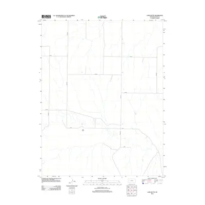
2012 Map of Lone Butte
USGS Topo · Published 2012About this map
Lone Butte rises as the primary landmark in this section of Logan County, defining a landscape marked by an orderly grid of rural transport and drainage. The 2012 environment is characterized by long, straight sections of named county roads that serve the agricultural interior, including Gold, Hunter, and Fawn. This network reflects the late twentieth-century expansion of rural infrastructure into the High Plains, where local names such as Kiowa, Jayhawk, and Indian designate specific corridors of travel. The map provides a precise record of the section-line road system, including numbered routes like Co Rd 240 and Co Rd 270, which facilitate movement through this sparsely populated ranching and farming territory south of the Smoky Hill River valley.
Find a feature on this map
12 named features on this map. Tap any name to fly to it.
Don’t see what you’re looking for? This feature index may not catch every label — zoom into the map to look around manually.
Map Details
Editions of this 2012 Lone Butte Map
This is the sole edition of this map. No revisions or reprints were ever made.
Other maps of this area

1939 · Pence
USGS Topo · 1:62,500

1941 · Pence
USGS Topo · 1:62,500

1955 · Scott City
USGS Topo · 1:250,000

1958 · Scott City
USGS Topo · 1:250,000

1968 · Russell Springs 3 NE
USGS Topo · 1:24,000

1969 · Russell Springs 2 NE
USGS Topo · 1:24,000

1969 · Russell Springs 2 SE
USGS Topo · 1:24,000

1972 · Russell Springs
USGS Topo · 1:24,000
1972 · Russell Springs NE
USGS Topo · 1:24,000
1974 · Lone Butte
USGS Topo · 1:24,000