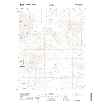
2018 Map of Lone Butte
USGS Topo · Published 2018About this map
Ridgecrest sits at a critical intersection of desert valleys and high-security industrial corridors on the western edge of the Mojave Desert. The landscape is dominated by the transition from the Indian Wells Valley in the west to the Salt Wells Valley in the east, bounded by the imposing elevations of the Argus Range. The presence of specialized infrastructure like Pilot Plant Rd, Magazine Rd, and several named access routes such as Tare Access Rd and Court Access Rd points to the area's deep history with the neighboring naval testing facilities. To the north, the expanse of China Lake marks the dry lake bed that has long served as a focal point for regional geography and military research. The local topography is punctuated by the distinct volcanic rise of Lone Butte, providing a clear landmark amidst the network of desert roads like Randsburg Wash Rd.
Find a feature on this map
44 named features on this map. Tap any name to fly to it.
Don’t see what you’re looking for? This feature index may not catch every label — zoom into the map to look around manually.
Map Details
Editions of this 2018 Lone Butte Map
This is the sole edition of this map. No revisions or reprints were ever made.
Other maps of this area

1915 · Searles Lake
USGS Topo · 1:250,000

1947 · Trona
USGS Topo · 1:250,000

1948 · Trona
USGS Topo · 1:250,000

1949 · Trona
USGS Topo · 1:62,500

1949 · Searles Lake
USGS Topo · 1:62,500

1950 · Searles Lake
USGS Topo · 1:62,500

1950 · Trona
USGS Topo · 1:62,500

1953 · Mountain Springs Canyon
USGS Topo · 1:62,500

1953 · Ridgecrest
USGS Topo · 1:62,500

1953 · Trona
USGS Topo · 1:250,000