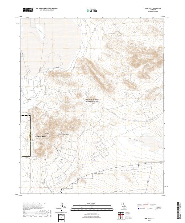
2021 Map of Lone Butte
USGS Topo · Published 2021About this map
Ridgecrest sits at the western edge of this desert landscape, where the urban grid meets the open reaches of the Indian Wells Valley. This 2021 survey illustrates the interface between modern municipal development and the high desert terrain of the Mojave Desert. The topography is dominated by the Argus Range in the northeast and the isolated rising of Lone Butte near the center. Transport and infrastructure define the area's layout, with a network of access roads including Magazine Rd, Tare Access Rd, and Court Access Rd cutting across the alluvial fans. To the east, the terrain descends into the Salt Wells Valley, while the southern section is bisected by Trona Rd and Randsburg Wash Rd. The map also captures specialized industrial or research footprints indicated by markers like Pilot Plant Rd and the water feature at Lark Seep.
Find a feature on this map
34 named features on this map. Tap any name to fly to it.
Don’t see what you’re looking for? This feature index may not catch every label — zoom into the map to look around manually.
Map Details
Editions of this 2021 Lone Butte Map
This is the sole edition of this map. No revisions or reprints were ever made.
Other maps of this area

1915 · Searles Lake
USGS Topo · 1:250,000

1947 · Trona
USGS Topo · 1:250,000

1948 · Trona
USGS Topo · 1:250,000

1949 · Trona
USGS Topo · 1:62,500

1949 · Searles Lake
USGS Topo · 1:62,500

1950 · Searles Lake
USGS Topo · 1:62,500

1950 · Trona
USGS Topo · 1:62,500

1953 · Mountain Springs Canyon
USGS Topo · 1:62,500

1953 · Ridgecrest
USGS Topo · 1:62,500

1953 · Trona
USGS Topo · 1:250,000