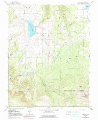
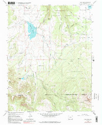
1964 Map of Lone Cone
USGS Topo · Published 1991About this map
Lone Cone towers over this landscape at the intersection of San Miguel and Dolores counties, anchoring a high-country region defined by ranching and water management. The mapping reflects a specialized mountain economy in the mid-1960s, where seasonal operations like Redd Ranchs Summer Camp, Barrett Cow Camp, and Davis Sheep Camp are scattered across the flats and gulches. Significant irrigation and water storage infrastructure is evident through the presence of Miramonte Reservoir, Stockdale Reservoir, and the Lilylands Canal system, which redirects flow from various branches of Naturita Creek. The southern portion of the map transitions into the high peaks of the Uncompahgre National Forest, where features such as Preachers Hole and the Devils Chair suggest a rugged, high-elevation terrain that challenged early surveyors and continues to serve as an active range for local livestock operations.
Find a feature on this map
39 named features on this map. Tap any name to fly to it.
Don’t see what you’re looking for? This feature index may not catch every label — zoom into the map to look around manually.
Map Details
Editions of this 1964 Lone Cone Map
5 editions found
Other maps of this area

1956 · Cortez
USGS Topo · 1:250,000

1956 · Moab
USGS Topo · 1:250,000

1958 · Cortez
USGS Topo · 1:250,000

1959 · Cortez
USGS Topo · 1:250,000

1959 · Moab
USGS Topo · 1:250,000

1960 · Moab
USGS Topo · 1:250,000

1962 · Moab
USGS Topo · 1:250,000

1962 · Cortez
USGS Topo · 1:250,000

1964 · Moab
USGS Topo · 1:250,000
1964 · Groundhog Reservoir
USGS Topo · 1:24,000