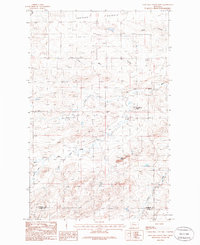
1985 Map of Lone Man Coulee West
USGS Topo · Published 1986About this map
The Marias River and its intricate drainage network dominate this landscape in north-central Montana, where several forks converge to carve deep impressions into the prairie. The map records the New Miami Colony in the eastern portion of the quadrangle, complete with its own Sewage Disposal Pond and a water tank marked WT. This communal settlement sits near the confluence of the Dry Fork Marias River and the main river channel, highlighting the importance of water access in this semi-arid region.
Find a feature on this map
20 named features on this map. Tap any name to fly to it.
Don’t see what you’re looking for? This feature index may not catch every label — zoom into the map to look around manually.
Map Details
Editions of this 1985 Lone Man Coulee West Map
This is the sole edition of this map. No revisions or reprints were ever made.
Other maps of this area

1920 · Dupuyer
USGS Topo · 1:125,000

1934 · Lake Frances
USGS Topo · 1:48,000

1934 · Valier
USGS Topo · 1:62,500

1936 · Pendroy
USGS Topo · 1:48,000

1937 · Valier
USGS Topo · 1:62,500

1937 · Lake Frances
USGS Topo · 1:62,500

1938 · Gallup City
USGS Topo · 1:62,500

1941 · Pendroy
USGS Topo · 1:62,500

1942 · Gallup City
USGS Topo · 1:62,500

1960 · Cut Bank
USGS Topo · 1:250,000