
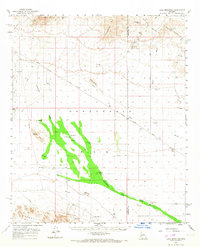
1961 Map of Lone Mountain
USGS Topo · Published 1963About this map
The Harquahala Plain dominates this desert landscape, framed by the steep rises of the Harquahala Mts and the Big Horn Mountains. In the early 1960s, this area of the Arizona desert was defined by a network of isolated mines and vital water sources. Prospectors and miners left their mark at sites like the Socorro Mine, Lions Den Mine, and Alaska Mine, while the Weldon Hill mill stands as a remnant of local industry.
Find a feature on this map
41 named features on this map. Tap any name to fly to it.
Don’t see what you’re looking for? This feature index may not catch every label — zoom into the map to look around manually.
Map Details
Editions of this 1961 Lone Mountain Map
2 editions found
Other maps of this area

1942 · Vicksburg
USGS Topo · 1:250,000

1954 · Phoenix
USGS Topo · 1:250,000

1957 · Phoenix
USGS Topo · 1:250,000

1958 · Phoenix
USGS Topo · 1:250,000

1960 · Phoenix
USGS Topo · 1:250,000

1961 · Salome
USGS Topo · 1:62,500

1961 · Hope
USGS Topo · 1:62,500

1961 · Big Horn Mts
USGS Topo · 1:62,500

1961 · Gladden
USGS Topo · 1:62,500

1962 · Little Horn Mts
USGS Topo · 1:62,500