
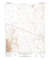
1961 Map of Lone Mtn
USGS Topo · Published 1962About this map
The high-desert mining and transport landscape of Big Smoky Valley is documented here during the early 1960s, revealing a region defined by its industrial transit and water sources. The settlement of Millers sits prominently along the Old Railroad Grade, a corridor that once served the booming silver and gold districts of the era. Evidence of the region's mineral processing is found in features like the Tailings Pond and Gravel Pits, while the natural topography is marked by the San Antonio Mountains and the distinct Crescent Dunes. Water, a critical resource in this arid environment, is captured at Montezuma Wells and Willow Spring. The map also preserves local history through the notation of a Cem and Graves near the rail corridor, providing specific points of interest for genealogists studying the families that worked these desert outposts.
Find a feature on this map
24 named features on this map. Tap any name to fly to it.
Don’t see what you’re looking for? This feature index may not catch every label — zoom into the map to look around manually.
Map Details
Editions of this 1961 Lone Mtn Map
2 editions found
Other maps of this area

1898 · Silver Peak
USGS Topo · 1:125,000

1900 · Silver Peak
USGS Topo · 1:125,000

1907 · Tonopah
USGS Topo · 1:250,000

1908 · Lida
USGS Topo · 1:250,000

1908 · Tonopah
USGS Topo · 1:250,000

1913 · Lida
USGS Topo · 1:250,000

1945 · Goldfield
USGS Topo · 1:125,000

1952 · Mud Lake
USGS Topo · 1:62,500

1954 · Goldfield
USGS Topo · 1:250,000

1955 · Goldfield
USGS Topo · 1:250,000