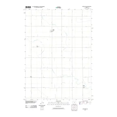
2010 Map of Lone Rock
USGS Topo · Published 2010About this map
Lone Rock serves as the primary hub of this North Central Iowa landscape, situated along the upper reaches of Calamus Creek. The region is defined by a rigorous grid of section-line roads, such as 330th St and 100th Ave, which partition the fertile agricultural land. The map provides significant genealogical value, documenting sites like the Fenton Township Cemetery and the Union Township Cemetery. Of particular note is the location of Johnson's Settlement Post Office in the southeastern quadrant, a marker of earlier settlement patterns near the winding path of Black Cat Creek. The persistence of these rural institutions, including the Lone Rock Post Office, highlights the enduring nature of these small farming communities. To the west, the landscape is further drained by Fourmile Creek near the small settlement of Lotts Creek, illustrating the intricate drainage network essential to the local prairie-turned-farmland.
Find a feature on this map
25 named features on this map. Tap any name to fly to it.
Don’t see what you’re looking for? This feature index may not catch every label — zoom into the map to look around manually.
Map Details
Editions of this 2010 Lone Rock Map
This is the sole edition of this map. No revisions or reprints were ever made.
Other maps of this area

1954 · Fairmont
USGS Topo · 1:250,000

1958 · Fairmont
USGS Topo · 1:250,000

1972 · Algona
USGS Topo · 1:24,000

1972 · Bancroft
USGS Topo · 1:24,000

1972 · Burt
USGS Topo · 1:24,000

1980 · Lone Rock
USGS Topo · 1:24,000

1980 · Fenton
USGS Topo · 1:24,000

1980 · Seneca
USGS Topo · 1:24,000

1980 · Armstrong SE
USGS Topo · 1:24,000

1980 · Hobarton
USGS Topo · 1:24,000