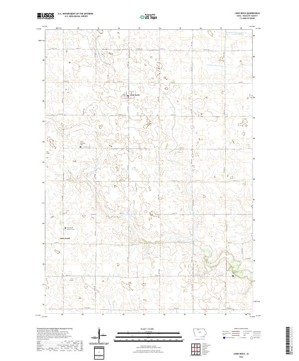
2022 Map of Lone Rock
USGS Topo · Published 2022About this map
Lone Rock serves as the primary settlement hub for this agricultural landscape in Kossuth County, characterized by a meticulous grid of rural roads and water management systems. The town is situated along Reba St and Co Rd B19, hosting a local Po that has historically anchored this farming community. The terrain is defined by the winding paths of Black Cat Cr, Calamus Cr, and Fourmile Cr, which meander through the section lines alongside engineered features like Drainage Ditch Number 69.
Find a feature on this map
28 named features on this map. Tap any name to fly to it.
Don’t see what you’re looking for? This feature index may not catch every label — zoom into the map to look around manually.
Map Details
Editions of this 2022 Lone Rock Map
This is the sole edition of this map. No revisions or reprints were ever made.
Other maps of this area

1954 · Fairmont
USGS Topo · 1:250,000

1958 · Fairmont
USGS Topo · 1:250,000

1972 · Algona
USGS Topo · 1:24,000

1972 · Bancroft
USGS Topo · 1:24,000

1972 · Burt
USGS Topo · 1:24,000

1980 · Lone Rock
USGS Topo · 1:24,000

1980 · Fenton
USGS Topo · 1:24,000

1980 · Seneca
USGS Topo · 1:24,000

1980 · Armstrong SE
USGS Topo · 1:24,000

1980 · Hobarton
USGS Topo · 1:24,000