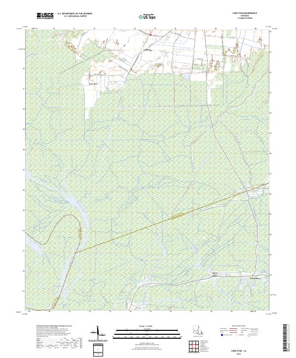
2024 Map of Lone Star
USGS Topo · Published 2024About this map
The low-lying wetlands of southern Louisiana define this landscape where the borders of Iberville, Assumption, and Iberia Parishes converge. In the northern reaches, the small settlements of Goldridge and Lone Star are accessible via a network of local roads including Richland Rd and Lone Star Rd, reflecting a landscape shared between habitation and resource extraction as evidenced by Shell Oil Field Rd.
Find a feature on this map
42 named features on this map. Tap any name to fly to it.
Don’t see what you’re looking for? This feature index may not catch every label — zoom into the map to look around manually.
Map Details
Editions of this 2024 Lone Star Map
This is the sole edition of this map. No revisions or reprints were ever made.
Other maps of this area

1935 · Chicot Lake
USGS Topo · 1:62,500

1936 · White Castle
USGS Topo · 1:62,500

1945 · New Orleans
USGS Topo · 1:250,000

1948 · Foster
USGS Topo · 1:62,500

1953 · Napoleonville
USGS Topo · 1:62,500

1953 · Crescent
USGS Topo · 1:24,000
1953 · White Castle
USGS Topo · 1:24,000
1953 · Carville
USGS Topo · 1:24,000

1954 · Chicot Lake
USGS Topo · 1:62,500

1954 · Baton Rouge
USGS Topo · 1:250,000