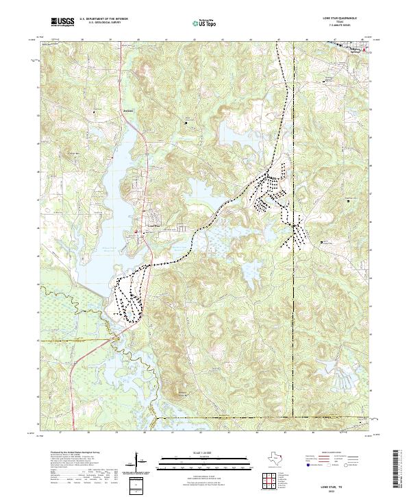
2022 Map of Lone Star
USGS Topo · Published 2022About this map
The town of Lone Star serves as the focal point of this northeast Texas landscape, where the local economy and geography are deeply intertwined with the presence of iron resources. The settlement pattern is defined by significant water bodies, notably the Ellison Creek Reservoir and Barnes Creek Reservoir, which dominate the central terrain. These reservoirs are fed by a complex drainage system including Barnes Creek and Brutons Creek, cutting through a topography marked by the Black Mountains and Fowler Mountain.
Find a feature on this map
118 named features on this map. Tap any name to fly to it.
Don’t see what you’re looking for? This feature index may not catch every label — zoom into the map to look around manually.
Map Details
Editions of this 2022 Lone Star Map
This is the sole edition of this map. No revisions or reprints were ever made.
Other maps of this area

1914 · Daingerfield
USGS Topo · 1:62,500

1953 · Texarkana
USGS Topo · 1:250,000

1956 · Texarkana
USGS Topo · 1:250,000

1956 · Tyler
USGS Topo · 1:250,000

1960 · Coffeeville
USGS Topo · 1:24,000

1960 · La Fayette
USGS Topo · 1:24,000

1961 · Lassater
USGS Topo · 1:24,000

1962 · Avinger
USGS Topo · 1:24,000

1962 · Ore City
USGS Topo · 1:24,000

1962 · Lone Star
USGS Topo · 1:24,000