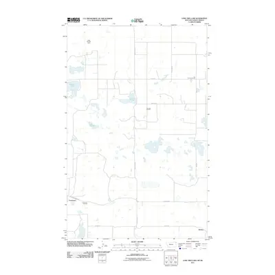
2011 Map of Lone Tree Lake
USGS Topo · Published 2011About this map
Comertown sits at the southern edge of this Sheridan County landscape, where the prairie begins its transition toward the international border. The survey reveals a region defined by its reliance on water management and small rural hubs, centered around the eponymous Lone Tree Lake. Further north, McElroy appears as a small settlement point along the grid of section roads like North Star Rd and McElroy. This corner of Montana is dotted with small wetlands and depressions including Widgeon Slough and Larson Slough, while the Reed Number 1 Dam indicates local efforts to harness surface water in a semi-arid climate. Genealogists can trace family footprints across several burial sites, including Comertown Cemetery, Lone Tree Cemetery, and Our Saviors Cemetery, which remain as quiet landmarks in an area dominated by large-scale agricultural parcels.
Find a feature on this map
17 named features on this map. Tap any name to fly to it.
Don’t see what you’re looking for? This feature index may not catch every label — zoom into the map to look around manually.
Map Details
Editions of this 2011 Lone Tree Lake Map
This is the sole edition of this map. No revisions or reprints were ever made.
Other maps of this area

1954 · Wolf Point
USGS Topo · 1:250,000

1958 · Wolf Point
USGS Topo · 1:250,000

1983 · Tadpole Lake
USGS Topo · 1:24,000

1983 · Dooley SE
USGS Topo · 1:24,000

1983 · Lone Tree Lake
USGS Topo · 1:24,000

1983 · Park Lake
USGS Topo · 1:24,000

1983 · Westby South
USGS Topo · 1:24,000

1983 · Westby North
USGS Topo · 1:24,000
2011 · Dooley SE
USGS Topo · 1:24,000
2011 · Tadpole Lake
USGS Topo · 1:24,000