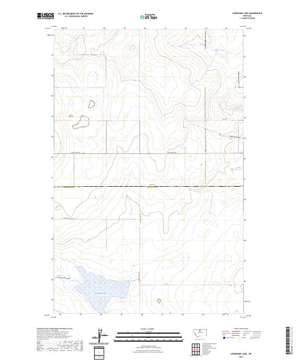
2024 Map of Lonesome Lake
USGS Topo · Published 2024About this map
Lonesome Lake anchors the southern reaches of this landscape, where the border of Hill County meets Chouteau County in north-central Montana. The terrain is defined by the gradual transition of the plains, broken by natural drainage features like Twelvemile Coulee and Barneys Coulee. A sparse but essential network of rural transit lines provides access across the townships, including Box Elder Rd and Ihmsen Well Rd. This area reflects the expansive, low-density settlement patterns of the modern Big Sky country, where roads often follow Section and Township lines, such as those in t30n r11e and t29n r12e. The presence of Ft 115 and Rd 295 S suggests the continued importance of land management and agricultural access in this open prairie environment.
Find a feature on this map
13 named features on this map. Tap any name to fly to it.
Don’t see what you’re looking for? This feature index may not catch every label — zoom into the map to look around manually.
Map Details
Editions of this 2024 Lonesome Lake Map
This is the sole edition of this map. No revisions or reprints were ever made.
Other maps of this area

1904 · Boxelder
USGS Topo · 1:62,500

1906 · Lonesome
USGS Topo · 1:62,500

1906 · Boxelder
USGS Topo · 1:62,500

1919 · Big Sandy
USGS Topo · 1:125,000

1954 · Shelby
USGS Topo · 1:250,000

1958 · Shelby
USGS Topo · 1:250,000

1969 · Box Elder NW
USGS Topo · 1:24,000
1969 · Lonesome Lake
USGS Topo · 1:24,000
1969 · Big Sandy
USGS Topo · 1:24,000
1969 · Fourteenmile Coulee SE
USGS Topo · 1:24,000