
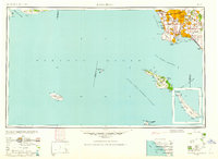
1960 Map of Long Beach
USGS Topo · Published 1960About this map
The dense urban expansion of the Los Angeles Basin meets the Pacific Ocean in this mid-century portrait of the Southern California coast. Post-war suburban growth is evident in the grid systems connecting inland centers like Whittier and Downey to coastal communities from Santa Monica down to Artesia. The map highlights the critical industrial and maritime infrastructure of the era, specifically the expansive Los Angeles Harbor and the adjacent Terminal Island, which served as the primary gateway for the region's burgeoning trade.
Find a feature on this map
77 named features on this map. Tap any name to fly to it.
Don’t see what you’re looking for? This feature index may not catch every label — zoom into the map to look around manually.
Map Details
Editions of this 1960 Long Beach Map
2 editions found
Other maps of this area

1894 · Los Angeles
USGS Topo · 1:62,500

1894 · Pomona
USGS Topo · 1:62,500

1896 · Santa Ana
USGS Topo · 1:62,500

1896 · Pasadena
USGS Topo · 1:62,500

1896 · Anaheim
USGS Topo · 1:62,500

1896 · Redondo
USGS Topo · 1:62,500

1896 · Las Bolsas
USGS Topo · 1:62,500

1896 · Santa Monica
USGS Topo · 1:62,500

1896 · San Pedro
USGS Topo · 1:62,500

1896 · Downey
USGS Topo · 1:62,500