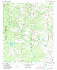
1979 Map of Long Branch
USGS Topo · Published 1989About this map
The Salkehatchie River and its swampy tributaries dominate this Barnwell County landscape, providing a stark contrast to the nearby industrial and aeronautic developments of the late 1970s. Along its western edge, the map documents a portion of the Savannah River Plant Department of Energy, marked by significant Restricted zones. This juxtaposition of a highly secure federal nuclear facility against traditional rural settlements like Snelling and Rosemary illustrates the mid-century transformation of the South Carolina lowcountry.
Find a feature on this map
28 named features on this map. Tap any name to fly to it.
Don’t see what you’re looking for? This feature index may not catch every label — zoom into the map to look around manually.
Map Details
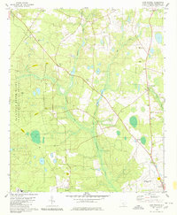
Editions of this 1979 Long Branch Map
2 editions found
Other maps of this area

1919 · Allendale
USGS Topo · 1:62,500

1920 · Ellenton
USGS Topo · 1:48,000

1920 · Talatha
USGS Topo · 1:48,000

1921 · Talatha
USGS Topo · 1:62,500

1921 · Ellenton
USGS Topo · 1:62,500

1923 · Williston
USGS Topo · 1:48,000

1927 · Williston
USGS Topo · 1:62,500

1943 · Allendale
USGS Topo · 1:62,500

1943 · Augusta East
USGS Topo · 1:125,000

1943 · Williston
USGS Topo · 1:62,500