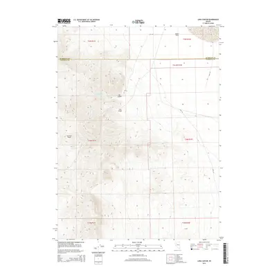
2014 Map of Long Canyon
USGS Topo · Published 2014About this map
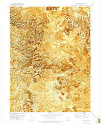
The Antelope Range dominates this landscape along the boundary line where Humboldt and Pershing Counties meet in northwestern Nevada. The terrain is defined by dramatic elevation changes, where high ridges descend into the Desert Valley in the northeast. Water is a critical and sparse resource here, highlighted by the naming of Box Canyon Spring Number Two within the drainage of Box Canyon. Transportation through this arid region relies on two primary unpaved routes: Jungo Rd, which skirts the eastern edge of the mountains, and Ely Rd in the north. This 2014 survey documents a classic Great Basin environment where deep incisions like Long Canyon provide the only breaks in the north-south trending mountain front.
Find a feature on this map
15 named features on this map. Tap any name to fly to it.
Don’t see what you’re looking for? This feature index may not catch every label — zoom into the map to look around manually.
Map Details
Editions of this 2014 Long Canyon Map
This is the sole edition of this map. No revisions or reprints were ever made.
Other maps of this area

1931 · Lovelock
USGS Topo · 1:250,000

1935 · Lovelock
USGS Topo · 1:250,000

1955 · Lovelock
USGS Topo · 1:250,000

1959 · Lovelock
USGS Topo · 1:250,000

1971 · Majuba Mtn
USGS Topo · 1:24,000

1971 · Rye Patch Reservoir North
USGS Topo · 1:24,000
1971 · Jungo
USGS Topo · 1:24,000
1971 · Jungo NE
USGS Topo · 1:24,000
1971 · Alpha Mountain
USGS Topo · 1:24,000
1971 · Long Canyon
USGS Topo · 1:24,000