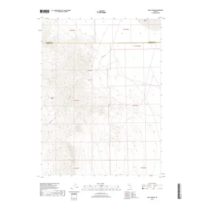
2018 Map of Long Canyon
USGS Topo · Published 2018About this map
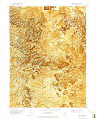
The Antelope Range dominates this portion of the Great Basin, where the high desert terrain transitions into the wide expanse of Desert Valley. This 2018 survey documents a landscape defined by significant elevation changes and deep natural drainages, most notably Long Canyon and Box Canyon. A critical water source for the area is identified at Box Canyon Spring Number Two, located within the western reaches of the mountains. Human activity is sparse, marked primarily by the inclusion of Ely Rd which cuts through the northeastern corner of the sheet. The map also delineates the precise boundary between Humboldt Co and Pershing Co, providing a clear record of the jurisdictional division across this remote stretch of Nevada.
Find a feature on this map
14 named features on this map. Tap any name to fly to it.
Don’t see what you’re looking for? This feature index may not catch every label — zoom into the map to look around manually.
Map Details
Editions of this 2018 Long Canyon Map
This is the sole edition of this map. No revisions or reprints were ever made.
Other maps of this area

1931 · Lovelock
USGS Topo · 1:250,000

1935 · Lovelock
USGS Topo · 1:250,000

1955 · Lovelock
USGS Topo · 1:250,000

1959 · Lovelock
USGS Topo · 1:250,000

1971 · Majuba Mtn
USGS Topo · 1:24,000

1971 · Rye Patch Reservoir North
USGS Topo · 1:24,000
1971 · Jungo
USGS Topo · 1:24,000
1971 · Jungo NE
USGS Topo · 1:24,000
1971 · Alpha Mountain
USGS Topo · 1:24,000
1971 · Long Canyon
USGS Topo · 1:24,000