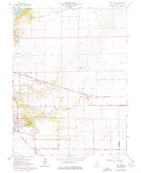
1967 Map of Long Creek
USGS Topo · Published 1976About this map
Lake Decatur Elevation 613 and the Sangamon River anchor the northwest corner of this Central Illinois landscape, where a dense network of railroads reflects the region's mid-century industrial and agricultural connectivity. The Norfolk and Western and Baltimore and Ohio lines cross the prairie, serving rural elevators and connecting smaller settlements like Oakley and Casner. Around Mount Zion and the village of Long Creek, the map captures a period of growth as residential footprints expand near Spitler Woods State Park and Camp Warren. This 1967 survey, updated with 1975 revisions, preserves a detailed record of the rural landscape before late-century suburbanization, showing several country burial grounds such as Point Pleasant Cem and the Salem Sch, alongside active resource extraction sites like the Gravel Pits north of Decatur.
Find a feature on this map
33 named features on this map. Tap any name to fly to it.
Don’t see what you’re looking for? This feature index may not catch every label — zoom into the map to look around manually.
Map Details
Editions of this 1967 Long Creek Map
2 editions found
Other maps of this area

1929 · Decatur
USGS Topo · 1:62,500

1933 · Decatur
USGS Topo · 1:62,500

1935 · Sullivan
USGS Topo · 1:48,000

1940 · Sullivan
USGS Topo · 1:62,500

1949 · Dalton City
USGS Topo · 1:62,500

1955 · Bement
USGS Topo · 1:62,500

1958 · Decatur
USGS Topo · 1:250,000

1961 · Decatur
USGS Topo · 1:250,000

1967 · Long Creek
USGS Topo · 1:24,000
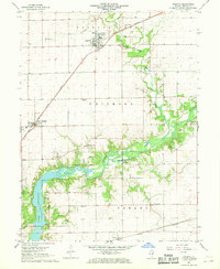
1967 · Argenta
USGS Topo · 1:24,000