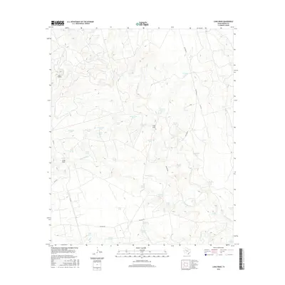
2016 Map of Long Draw
USGS Topo · Published 2016About this map
The Colorado River snakes through this arid Borden County landscape, defining a terrain dominated by drainage networks and water management infrastructure. This ranching country relies on a complex system of named tanks to sustain livestock, including the Railroad Tank, Seepy Tank, and several specialized reservoirs like the New Green Tank and Salt Draw Tank. Notable topographic depressions such as Coon Hollow and the titular Long Draw provide crucial orientation in an area otherwise characterized by subtle elevation shifts. Local transport is facilitated by rural routes like Muleshoe Rd and FM 1054, which cut across the watersheds of Tobacco Cr and Salt Cr. The presence of Creighton Lake near Co RD 257 stands out as a significant permanent water feature in a region where seasonal draws and ephemeral creeks dictate the rhythm of the land.
Find a feature on this map
45 named features on this map. Tap any name to fly to it.
Don’t see what you’re looking for? This feature index may not catch every label — zoom into the map to look around manually.
Map Details
Editions of this 2016 Long Draw Map
This is the sole edition of this map. No revisions or reprints were ever made.
Other maps of this area

1954 · Big Spring
USGS Topo · 1:250,000

1958 · Big Spring
USGS Topo · 1:250,000

1969 · Gail
USGS Topo · 1:24,000

1969 · Indian Canyon
USGS Topo · 1:24,000

1969 · Holloway Canyon
USGS Topo · 1:24,000

1970 · Vealmoor
USGS Topo · 1:24,000

1970 · Mushaway Peak
USGS Topo · 1:24,000

1970 · Ackerly
USGS Topo · 1:24,000
1970 · Gunsight Draw
USGS Topo · 1:24,000

1970 · Sand Creek
USGS Topo · 1:24,000