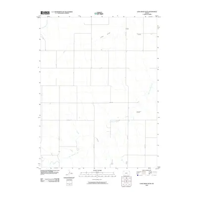
2009 Map of Long Draw South
USGS Topo · Published 2009About this map
South Fork Sappa Creek meanders through the heart of this High Plains landscape in Rawlins County, defining a topography of drainage patterns that converge toward the northeast. The rural character of the area is emphasized by a sparse network of county roads, such as Co RD DD and Co RD CC, which segment the terrain into wide agricultural blocks. For the local historian or genealogist, the map preserves the exact locations of three distinct burial grounds: Lone Star Cemetery, Saint Patrick Cemetery, and Cumberland Cemetery. These sites, along with the distinct geological depression of Long Draw, offer concrete landmarks for tracing family histories and land use in this section of northwest Kansas.
Find a feature on this map
13 named features on this map. Tap any name to fly to it.
Don’t see what you’re looking for? This feature index may not catch every label — zoom into the map to look around manually.
Map Details
Editions of this 2009 Long Draw South Map
This is the sole edition of this map. No revisions or reprints were ever made.
Other maps of this area

1943 · Colby
USGS Topo · 1:62,500

1951 · Achilles
USGS Topo · 1:62,500

1951 · Chardon
USGS Topo · 1:62,500

1954 · Goodland
USGS Topo · 1:250,000

1956 · Goodland
USGS Topo · 1:250,000

1957 · Goodland
USGS Topo · 1:250,000

1965 · Achilles
USGS Topo · 1:24,000

1967 · Colby
USGS Topo · 1:24,000

1978 · Long Draw South
USGS Topo · 1:24,000

1978 · Achilles SE
USGS Topo · 1:24,000