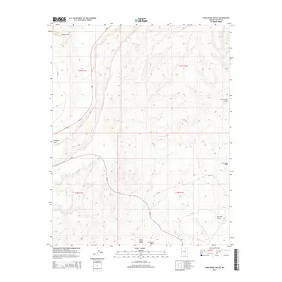
2014 Map of Long House Valley
USGS Topo · Published 2014About this map
Long House Valley and Wild Ram Valley dominate this landscape within the Navajo Nation, where the terrain is defined by complex drainage systems and high desert plateaus. Beda Tohie stands as the primary named settlement, located near the intersection of several significant transportation routes. Modern infrastructure like Us-160 cuts through the western portion of the valley, while Bureau of Indian Affairs routes such as Bia-41 and Bia-8034 provide access to more interior reaches of the high country. The map details numerous seasonal watercourses and topographic features including House Canyon, Yellow Water Canyon, and Coal Mine Wash. The alignment of these routes and the naming of specific valleys and canyons reflect the local importance of water and accessibility in this arid region of Northern Arizona.
Find a feature on this map
14 named features on this map. Tap any name to fly to it.
Don’t see what you’re looking for? This feature index may not catch every label — zoom into the map to look around manually.
Map Details
Editions of this 2014 Long House Valley Map
This is the sole edition of this map. No revisions or reprints were ever made.
Other maps of this area

1883 · Marsh Pass
USGS Topo · 1:250,000

1892 · Marsh Pass
USGS Topo · 1:250,000

1956 · Marble Canyon
USGS Topo · 1:250,000

1959 · Marble Canyon
USGS Topo · 1:250,000

1961 · Marble Canyon
USGS Topo · 1:250,000
1968 · Kayenta West
USGS Topo · 1:24,000

1968 · Marsh Pass
USGS Topo · 1:24,000

1968 · Yucca Hill
USGS Topo · 1:24,000
1968 · Marsh Pass SE
USGS Topo · 1:24,000

1970 · Shonto SE
USGS Topo · 1:24,000