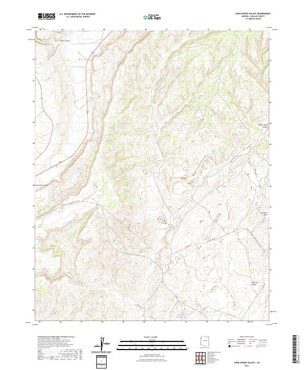
2021 Map of Long House Valley
USGS Topo · Published 2021About this map
Industrial infrastructure and natural drainages define this portion of Navajo County, where the Peabody Coal Company Access Rd and the Peabody Western Coal Haul Rd serve as the primary human imprint on the landscape. These dedicated transport routes, including the simply named Haul Rd and Haulage Rd, underscore the importance of the region's mineral extraction and energy economy.
Find a feature on this map
14 named features on this map. Tap any name to fly to it.
Don’t see what you’re looking for? This feature index may not catch every label — zoom into the map to look around manually.
Map Details
Editions of this 2021 Long House Valley Map
This is the sole edition of this map. No revisions or reprints were ever made.
Other maps of this area

1883 · Marsh Pass
USGS Topo · 1:250,000

1892 · Marsh Pass
USGS Topo · 1:250,000

1956 · Marble Canyon
USGS Topo · 1:250,000

1959 · Marble Canyon
USGS Topo · 1:250,000

1961 · Marble Canyon
USGS Topo · 1:250,000
1968 · Kayenta West
USGS Topo · 1:24,000

1968 · Marsh Pass
USGS Topo · 1:24,000

1968 · Yucca Hill
USGS Topo · 1:24,000
1968 · Marsh Pass SE
USGS Topo · 1:24,000

1970 · Shonto SE
USGS Topo · 1:24,000