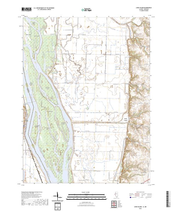
2024 Map of Long Island
USGS Topo · Published 2024About this map
Long Island and its complex network of side channels define this section of the Mississippi River valley between Illinois and Missouri. The landscape is heavily influenced by the presence of the Great River National Wildlife Refuge, which encompasses numerous riverine features like Smoots Chute, Canton Chute, and Indian Grave Lake. These waterways trace the shifting nature of the river's path, surrounding significant landforms such as Flannigan Island and Shandrew Island.
Find a feature on this map
73 named features on this map. Tap any name to fly to it.
Don’t see what you’re looking for? This feature index may not catch every label — zoom into the map to look around manually.
Map Details
Editions of this 2024 Long Island Map
This is the sole edition of this map. No revisions or reprints were ever made.
Other maps of this area

1903 · Kahoka
USGS Topo · 1:125,000

1903 · Palmyra
USGS Topo · 1:125,000

1925 · Quincy
USGS Topo · 1:62,500

1944 · Quincy
USGS Topo · 1:62,500

1945 · Quincy
USGS Topo · 1:62,500

1946 · Mendon
USGS Topo · 1:62,500

1948 · Quincy
USGS Topo · 1:250,000

1948 · Mendon
USGS Topo · 1:62,500

1949 · Maywood
USGS Topo · 1:24,000
1950 · Maywood
USGS Topo · 1:24,000