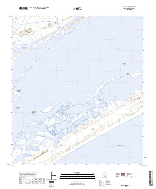
2025 Map of Long Island
USGS Topo · Published 2025About this map
Espiritu Santo Bay dominates this coastal landscape, where a complex network of barrier islands and shallow lagoons forms a dynamic interface with the Gulf of America. The modern Intracoastal Waterway cuts through these waters, providing a protected passage north of Long Island and Shoalwater Bay. This maritime environment is defined by its shifting sands and tidal features, from the expansive Matagorda Island shoreline to the submerged hazards of Josephine Reef. The map reveals the intricate hydrography of the Texas coast, including the First Chain of Islands and isolated bodies like South Pass Lake and Long Lake. While largely defined by water and wetlands, the presence of Lane Rd at the northern edge suggests the very beginning of landward infrastructure reaching toward these tidal flats and marshes.
Find a feature on this map
20 named features on this map. Tap any name to fly to it.
Don’t see what you’re looking for? This feature index may not catch every label — zoom into the map to look around manually.
Map Details
Editions of this 2025 Long Island Map
This is the sole edition of this map. No revisions or reprints were ever made.
Other maps of this area

1952 · Mosquito Point
USGS Topo · 1:24,000

1952 · Pass Cavallo SW
USGS Topo · 1:24,000

1952 · Long Island
USGS Topo · 1:24,000

1952 · Seadrift NE
USGS Topo · 1:24,000

1952 · Panther Point
USGS Topo · 1:24,000

1952 · Seadrift
USGS Topo · 1:24,000
1952 · Panther Point NE
USGS Topo · 1:24,000

1952 · Port O'Connor
USGS Topo · 1:24,000

1953 · Beeville
USGS Topo · 1:250,000

1956 · Beeville
USGS Topo · 1:250,000