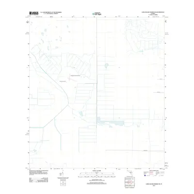
2012 Map of Long Island Marsh SE
USGS Topo · Published 2012About this map
Montgomery Ranch serves as a primary point of interest in this south Florida landscape, where agricultural operations and water management systems define the terrain. The presence of the Montgomery Ranch Airport reflects the logistical needs of large-scale ranching in this part of Charlotte County. The natural hydrology is dominated by the expansive Long Island Marsh and its associated drainage features, including Gator Branch, Joe Slough, and Gannet Slough. These slow-moving water bodies are characteristic of the region's flat topography. A network of local roads such as Farabee Rd, Ellie Ln, and Lott provide access to these remote reaches, revealing the persistent influence of drainage patterns and ranching boundaries on the modern rural infrastructure.
Find a feature on this map
9 named features on this map. Tap any name to fly to it.
Don’t see what you’re looking for? This feature index may not catch every label — zoom into the map to look around manually.
Map Details
Editions of this 2012 Long Island Marsh SE Map
This is the sole edition of this map. No revisions or reprints were ever made.
Other maps of this area

1953 · Venus NW
USGS Topo · 1:24,000

1956 · Telegraph Swamp NE
USGS Topo · 1:24,000

1956 · Telegraph Swamp NW
USGS Topo · 1:24,000

1956 · Long Island Marsh SW
USGS Topo · 1:24,000

1956 · West Palm Beach
USGS Topo · 1:250,000

1956 · Fort Pierce
USGS Topo · 1:250,000

1957 · West Palm Beach
USGS Topo · 1:250,000

1957 · Long Island Marsh NW
USGS Topo · 1:24,000

1957 · Long Island Marsh SE
USGS Topo · 1:24,000

1957 · Venus SW
USGS Topo · 1:24,000