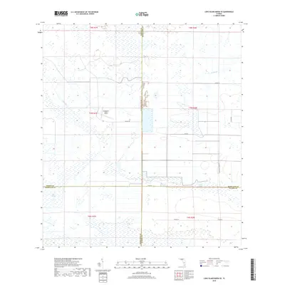
2018 Map of Long Island Marsh SE
USGS Topo · Published 2018About this map
Long Island Marsh and the surrounding wetlands of the Florida interior define this landscape where Charlotte, Highlands, DeSoto, and Glades counties meet. The area is characterized by a complex network of seasonal watercourses and drainage features, including the winding Tippen Bay, Gator Branch, and Joe Slough. Human activity is primarily centered on ranching and aviation, most notably at the Montgomery Ranch Airport located near SE Betty Dr. The map illustrates a transitional environment where traditional land use and natural hydrology intersect, preserved in a network of named grades and rural roads such as Lott Grade and John Pierce Grade Rd. These routes often follow the high ground between swampy depressions like Gannet Slough, reflecting the historical challenge of navigating this corner of the state.
Find a feature on this map
24 named features on this map. Tap any name to fly to it.
Don’t see what you’re looking for? This feature index may not catch every label — zoom into the map to look around manually.
Map Details
Editions of this 2018 Long Island Marsh SE Map
This is the sole edition of this map. No revisions or reprints were ever made.
Other maps of this area

1953 · Venus NW
USGS Topo · 1:24,000

1956 · Telegraph Swamp NE
USGS Topo · 1:24,000

1956 · Telegraph Swamp NW
USGS Topo · 1:24,000

1956 · Long Island Marsh SW
USGS Topo · 1:24,000

1956 · West Palm Beach
USGS Topo · 1:250,000

1956 · Fort Pierce
USGS Topo · 1:250,000

1957 · West Palm Beach
USGS Topo · 1:250,000

1957 · Long Island Marsh NW
USGS Topo · 1:24,000

1957 · Long Island Marsh SE
USGS Topo · 1:24,000

1957 · Venus SW
USGS Topo · 1:24,000