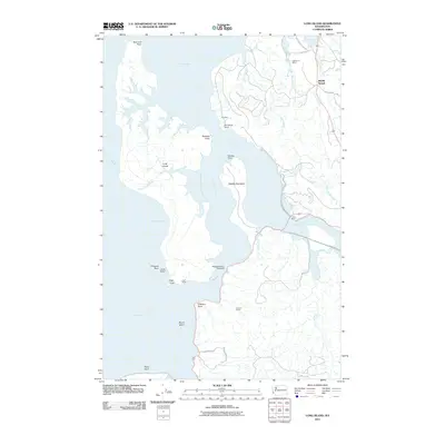
2011 Map of Long Island
USGS Topo · Published 2011About this map
Long Island dominates this coastal landscape within Willapa Bay, surrounded by a complex network of tidal sloughs and points. The geography is defined by the meeting of freshwater and saltwater, where the Naselle River, Middle Nemah River, and South Nemah River drain into the bay. Named ranches, including Lagergren Ranch, Mill Ranch, and Reef Ranch, suggest a history of coastal land use near the small settlement of Middle Nemah. The presence of the Templin Quarry near O'Meara Point and the Refuge Display Pool Dam reflects specialized human activity within this protected environment. Navigation and access are represented by numerous labeled points and points of entry, such as Chetlo Harbor and Diamond Point, while the terrain on the island itself includes the distinctly named Smoky Hollow.
Find a feature on this map
41 named features on this map. Tap any name to fly to it.
Don’t see what you’re looking for? This feature index may not catch every label — zoom into the map to look around manually.
Map Details
Editions of this 2011 Long Island Map
This is the sole edition of this map. No revisions or reprints were ever made.
Other maps of this area

1938 · Cape Disappointment
USGS Topo · 1:62,500

1938 · Cape Shoalwater
USGS Topo · 1:62,500

1938 · Fort Columbia
USGS Topo · 1:62,500

1938 · South Bend
USGS Topo · 1:62,500

1940 · South Bend
USGS Topo · 1:62,500

1943 · Fort Columbia
USGS Topo · 1:62,500

1943 · Copalis Beach
USGS Topo · 1:250,000

1949 · Chinook
USGS Topo · 1:24,000

1949 · Oman Ranch
USGS Topo · 1:24,000

1949 · Knappton
USGS Topo · 1:24,000