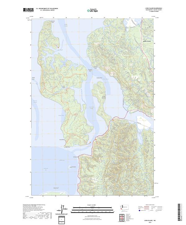
2023 Map of Long Island
USGS Topo · Published 2023About this map
Long Island serves as the centerpiece of this coastal survey, situated within the expansive Willapa National Wildlife Refuge. The map details a complex estuarine environment where the Middle Nemah River and South Nemah River meet Willapa Bay. Human presence is marked by the small settlement of Middle Nemah and a network of logging and access paths such as the Center Road Trl and Sawlog Trl. The geography is defined by numerous points and sloughs, including Stanley Point on the Stanley Peninsula and the winding Lewis Slough. To the south, the terrain rises significantly toward Bear River Ridge, contrasting with the low-lying tidal flats of Shoalwater Bay. This landscape represents a modern look at a protected Pacific Northwest wilderness, balancing preserved natural habitats like Smoky Hollow with the remains of coastal infrastructure.
Find a feature on this map
51 named features on this map. Tap any name to fly to it.
Don’t see what you’re looking for? This feature index may not catch every label — zoom into the map to look around manually.
Map Details
Editions of this 2023 Long Island Map
This is the sole edition of this map. No revisions or reprints were ever made.
Other maps of this area

1938 · Cape Disappointment
USGS Topo · 1:62,500

1938 · Cape Shoalwater
USGS Topo · 1:62,500

1938 · Fort Columbia
USGS Topo · 1:62,500

1938 · South Bend
USGS Topo · 1:62,500

1940 · South Bend
USGS Topo · 1:62,500

1943 · Fort Columbia
USGS Topo · 1:62,500

1943 · Copalis Beach
USGS Topo · 1:250,000

1949 · Chinook
USGS Topo · 1:24,000

1949 · Oman Ranch
USGS Topo · 1:24,000

1949 · Knappton
USGS Topo · 1:24,000