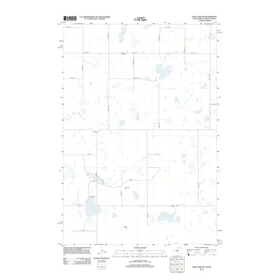
2012 Map of Long Lake NE
USGS Topo · Published 2012About this map
Glacial prairie potholes and scattered wetlands define the landscape of Albertha Township near the North Dakota and South Dakota border. This 2012 survey illustrates the section-line road grid that organizes the rural terrain, with Coldwater Lake and Rath Lake serving as prominent hydraulic features in an otherwise agricultural expanse. For genealogists and local historians, the map is particularly valuable for its documentation of small, family-associated or denominational burial grounds. Scattered across the township are the Saint Lucas Cem, Ehresman Cem, Saron Cem, and Gienger Cem, each marking a legacy of early settlement patterns in Dickey County. The transport network remains focused on local farm-to-market access, utilizing routes like Elm Rd and numbered avenues that follow the strict cardinal geometry of the Public Land Survey System.
Find a feature on this map
27 named features on this map. Tap any name to fly to it.
Don’t see what you’re looking for? This feature index may not catch every label — zoom into the map to look around manually.
Map Details
Editions of this 2012 Long Lake NE Map
This is the sole edition of this map. No revisions or reprints were ever made.
Other maps of this area

1896 · Edgeley
USGS Topo · 1:125,000

1899 · Ellendale
USGS Topo · 1:125,000

1925 · Edgeley
USGS Topo · 1:125,000

1953 · Jamestown
USGS Topo · 1:250,000

1954 · Aberdeen
USGS Topo · 1:250,000

1956 · Aberdeen
USGS Topo · 1:250,000

1956 · Jamestown
USGS Topo · 1:250,000

1968 · Long Lake
USGS Topo · 1:24,000

1968 · Long Lake SE
USGS Topo · 1:24,000

1968 · Long Lake NW
USGS Topo · 1:24,000