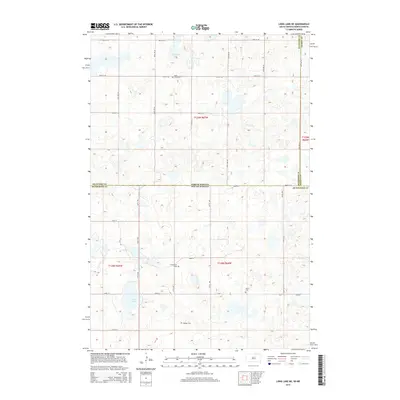
2015 Map of Long Lake NE
USGS Topo · Published 2015About this map
The state line between North Dakota and South Dakota bisects this prairie landscape, where the borders of McIntosh and McPherson counties meet. This survey captures a region defined by its wetland basins and rural cemetery sites, serving as a valuable resource for genealogists and local historians tracking family ties in the northern plains. Small, family-named burial grounds like Ehresman Cem, Gienger Cem, and Saron Cem are scattered across the townships, often representing the only remaining landmarks of early settlement clusters. To the north, the waters of Coldwater Lake dominate the terrain, while Rath Lake sits further south, connected by a network of sectional roads such as 98th ST Se and CR-6. The map illustrates the grid-based land organization typical of the era, preserving the precise locations of these historic community sites.
Find a feature on this map
24 named features on this map. Tap any name to fly to it.
Don’t see what you’re looking for? This feature index may not catch every label — zoom into the map to look around manually.
Map Details
Editions of this 2015 Long Lake NE Map
This is the sole edition of this map. No revisions or reprints were ever made.
Other maps of this area

1896 · Edgeley
USGS Topo · 1:125,000

1899 · Ellendale
USGS Topo · 1:125,000

1925 · Edgeley
USGS Topo · 1:125,000

1953 · Jamestown
USGS Topo · 1:250,000

1954 · Aberdeen
USGS Topo · 1:250,000

1956 · Aberdeen
USGS Topo · 1:250,000

1956 · Jamestown
USGS Topo · 1:250,000

1968 · Long Lake
USGS Topo · 1:24,000

1968 · Long Lake SE
USGS Topo · 1:24,000

1968 · Long Lake NW
USGS Topo · 1:24,000