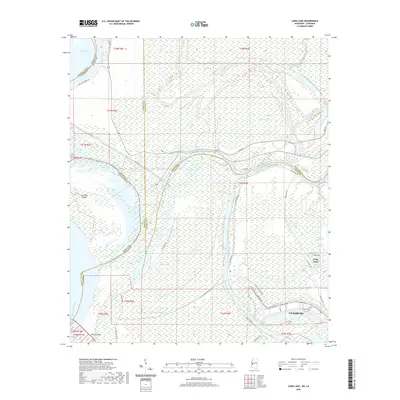
2020 Map of Long Lake
USGS Topo · Published 2020About this map
The industrial northern edge of Vicksburg meets the intricate hydrology of the Mississippi Delta in this recent survey. Dominated by the meandering courses of the Yazoo River and Mississippi River, the landscape is defined by its oxbow lakes and secondary waterways, including Steele Bayou, Willow Bayou, and Wilton Bayou. The area around the Long Lake settlement shows a transition from heavy industrial zones along Industrial Dr and the Port Terminal Cir to a more dispersed rural pattern further north.
Find a feature on this map
51 named features on this map. Tap any name to fly to it.
Don’t see what you’re looking for? This feature index may not catch every label — zoom into the map to look around manually.
Map Details
Editions of this 2020 Long Lake Map
This is the sole edition of this map. No revisions or reprints were ever made.
Other maps of this area

1909 · Millikens Bend
USGS Topo · 1:24,000

1909 · Mound
USGS Topo · 1:24,000

1910 · Mound
USGS Topo · 1:31,680

1918 · Vicksburg
USGS Topo · 1:62,500

1939 · Onward
USGS Topo · 1:62,500

1939 · Talla Bena
USGS Topo · 1:62,500

1939 · Alsatia
USGS Topo · 1:62,500

1941 · Vicksburg
USGS Topo · 1:62,500

1955 · Jackson
USGS Topo · 1:250,000

1961 · Jackson
USGS Topo · 1:250,000