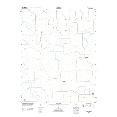
2011 Map of Long Lane
USGS Topo · Published 2011About this map
Wall Street and Long Lane anchor this rural Dallas County landscape, where the Niangua River winds through the western reaches. The settlement pattern is defined by small, dispersed communities like Earnestville, Handley, and Shady Grove, connected by an intricate web of county roads. Genealogists will find significant value in the distribution of local burial grounds, including Hill Cemetery and Pisgah Cemetery in the north, and Bethel Cemetery and Harris Cemetery further south. The topography is marked by the winding courses of Dousinbury Creek and Jones Creek, which drain the various hollows and ridges. This 2011 survey also records infrastructure such as the Thurman Lake Dam, showing a terrain where agricultural land meets the wooded valleys of Phillips Hollow and Patterson Branch.
Find a feature on this map
51 named features on this map. Tap any name to fly to it.
Don’t see what you’re looking for? This feature index may not catch every label — zoom into the map to look around manually.
Map Details
Editions of this 2011 Long Lane Map
This is the sole edition of this map. No revisions or reprints were ever made.
Other maps of this area

1884 · Springfield
USGS Topo · 1:125,000

1884 · Bolivar
USGS Topo · 1:125,000

1886 · Springfield
USGS Topo · 1:125,000

1892 · Bolivar
USGS Topo · 1:125,000

1939 · Long Lane
USGS Topo · 1:62,500

1942 · Long Lane
USGS Topo · 1:62,500

1946 · Niangua
USGS Topo · 1:62,500

1947 · Strafford
USGS Topo · 1:62,500

1948 · Niangua
USGS Topo · 1:62,500

1948 · Strafford
USGS Topo · 1:62,500