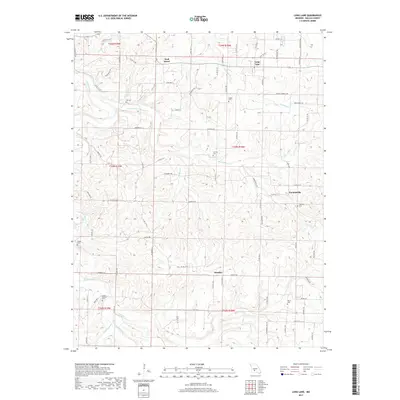
2017 Map of Long Lane
USGS Topo · Published 2017About this map
Wall Street and Long Lane anchor this Missouri landscape, situated within a complex network of waterways and rural roads. The area is defined by the winding course of the Niangua River to the west and numerous tributaries like Dousinbury Cr, Fourmile Cr, and Starvey Cr that carve through the local topography. This 2017 survey reveals a deeply established rural community, evidenced by the high concentration of family and local cemeteries such as Hill Cem, Pisgah Cem, and the uniquely named Jones-Cannon Cem. Small settlements like Earnestville and Handley are connected by a grid of county roads and state highways, including State Hwy V and State Rd FF. The map offers a detailed view of Missouri’s Ozark region, showing how the land has been partitioned and settled along watercourses like Bell Fork and Jones Cr over generations.
Find a feature on this map
87 named features on this map. Tap any name to fly to it.
Don’t see what you’re looking for? This feature index may not catch every label — zoom into the map to look around manually.
Map Details
Editions of this 2017 Long Lane Map
This is the sole edition of this map. No revisions or reprints were ever made.
Other maps of this area

1884 · Springfield
USGS Topo · 1:125,000

1884 · Bolivar
USGS Topo · 1:125,000

1886 · Springfield
USGS Topo · 1:125,000

1892 · Bolivar
USGS Topo · 1:125,000

1939 · Long Lane
USGS Topo · 1:62,500

1942 · Long Lane
USGS Topo · 1:62,500

1946 · Niangua
USGS Topo · 1:62,500

1947 · Strafford
USGS Topo · 1:62,500

1948 · Niangua
USGS Topo · 1:62,500

1948 · Strafford
USGS Topo · 1:62,500