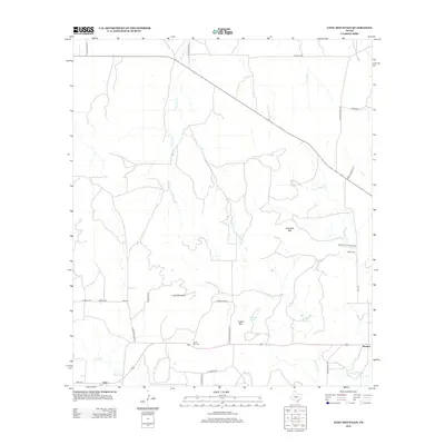
2012 Map of Long Mountain
USGS Topo · Published 2012About this map
Long Mountain rises as a central landmark in this portion of the Texas Hill Country, anchoring a landscape defined by seasonal creek beds and scattered family-named sites. The settlement of Erna sits at the southwestern edge, while Streeter is positioned to the southeast, connected by a network of rural roads such as El Paisano Rd and Home Place Rd. For those researching local families, the map identifies several burial sites including Jacoby Cem, Coffey Cem, and Long Mtn Cem. The drainage patterns of the Edwards Plateau are visible through the winding courses of Big Bluff Cr, Little Bluff Cr, and Spring Br, which carve through the terrain near elevations like Haystack Mtn and Cutoff Mtn. Evidence of earlier land management and local infrastructure is preserved in labels like the WPA Rd and the presence of Pluenneke Springs.
Find a feature on this map
32 named features on this map. Tap any name to fly to it.
Don’t see what you’re looking for? This feature index may not catch every label — zoom into the map to look around manually.
Map Details
Editions of this 2012 Long Mountain Map
This is the sole edition of this map. No revisions or reprints were ever made.
Other maps of this area

1887 · Mason
USGS Topo · 1:125,000

1894 · Mason
USGS Topo · 1:125,000

1954 · Llano
USGS Topo · 1:250,000

1955 · Llano
USGS Topo · 1:250,000

1956 · Llano
USGS Topo · 1:250,000
1968 · Turtle Creek
USGS Topo · 1:24,000

1968 · Sheep Run Creek
USGS Topo · 1:24,000

1968 · London
USGS Topo · 1:24,000
1970 · Calf Creek
USGS Topo · 1:24,000
1970 · Katemcy
USGS Topo · 1:24,000