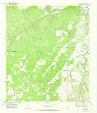
1970 Map of Katemcy
USGS Topo · Published 1973About this map
The San Saba River meanders across this Hill Country landscape, serving as a primary corridor for small settlements like Camp San Saba and Camp Air. At the turn of the 1970s, the area remained deeply rural, with a network of local branches such as Schmidt Branch, Cavin Branch, and Rumsey Creek draining the complex terrain toward the river. The map documents significant local landmarks for genealogists, including the Camp San Saba Cem and Bethel Ch, located near the southern reaches of the quadrangle.
Find a feature on this map
28 named features on this map. Tap any name to fly to it.
Don’t see what you’re looking for? This feature index may not catch every label — zoom into the map to look around manually.
Map Details
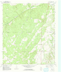
Editions of this 1970 Katemcy Map
2 editions found
Other maps of this area

1887 · Mason
USGS Topo · 1:125,000

1894 · Brady
USGS Topo · 1:125,000

1894 · Mason
USGS Topo · 1:125,000

1954 · Brownwood
USGS Topo · 1:250,000

1954 · Llano
USGS Topo · 1:250,000

1955 · Llano
USGS Topo · 1:250,000

1956 · Llano
USGS Topo · 1:250,000

1962 · Purdy Hill
USGS Topo · 1:24,000

1963 · Spy Rock
USGS Topo · 1:24,000
1963 · Voca
USGS Topo · 1:24,000