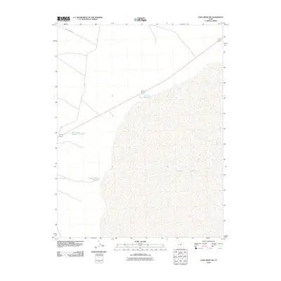
2010 Map of Long Ridge SW
USGS Topo · Published 2010About this map
Sevier Lake dominates the eastern half of this arid landscape, its expansive bed shown during a period of modern topographic monitoring in Millard County. The western portion of the quadrangle reveals a network of managed water resources essential for desert survival and land use, including Sevier Lake Reservoir Number 1 and Mud Flat Reservoir. This 2010 data highlights how local transport and infrastructure adapt to the basin's hydrology, with 3C Rd and Miller Canyon Rd providing the primary access through the open terrain. Smaller features like Miller Canyon Reservoir underscore the focused efforts to capture runoff in a region where water is the primary architect of human presence.
Find a feature on this map
8 named features on this map. Tap any name to fly to it.
Don’t see what you’re looking for? This feature index may not catch every label — zoom into the map to look around manually.
Map Details
Editions of this 2010 Long Ridge SW Map
This is the sole edition of this map. No revisions or reprints were ever made.
Other maps of this area

1908 · Fish Springs
USGS Topo · 1:250,000

1910 · Fish Springs
USGS Topo · 1:250,000

1953 · Richfield
USGS Topo · 1:250,000

1953 · Delta
USGS Topo · 1:250,000

1958 · Richfield
USGS Topo · 1:250,000

1958 · Delta
USGS Topo · 1:250,000

1960 · Notch Peak
USGS Topo · 1:62,500

1960 · The Barn
USGS Topo · 1:62,500

1962 · Delta
USGS Topo · 1:250,000
1972 · Long Ridge
USGS Topo · 1:24,000