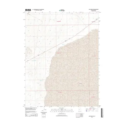
2014 Map of Long Ridge SW
USGS Topo · Published 2014About this map
Sevier Lake dominates the eastern half of this arid landscape, its vast bed representing a central geographic feature of the Sevier Desert. The 2014 survey reveals an environment defined by water management and transit, with Us-50 cutting diagonally across the northern contours of the basin. The western terrain is marked by smaller-scale water storage projects including Mud Flat Reservoir, Sevier Lake Reservoir Number 1, and Miller Canyon Reservoir. These features, along with the isolated track of Miller Canyon Rd, reflect the logistical challenges of ranching and resource management in Millard County. The map provides a clear look at the Public Land Survey System grid, which segments the desert into townships such as t20s r12w and t21s r11w, illustrating how the western Utah desert has been systematically partitioned.
Find a feature on this map
12 named features on this map. Tap any name to fly to it.
Don’t see what you’re looking for? This feature index may not catch every label — zoom into the map to look around manually.
Map Details
Editions of this 2014 Long Ridge SW Map
This is the sole edition of this map. No revisions or reprints were ever made.
Other maps of this area

1908 · Fish Springs
USGS Topo · 1:250,000

1910 · Fish Springs
USGS Topo · 1:250,000

1953 · Richfield
USGS Topo · 1:250,000

1953 · Delta
USGS Topo · 1:250,000

1958 · Richfield
USGS Topo · 1:250,000

1958 · Delta
USGS Topo · 1:250,000

1960 · Notch Peak
USGS Topo · 1:62,500

1960 · The Barn
USGS Topo · 1:62,500

1962 · Delta
USGS Topo · 1:250,000
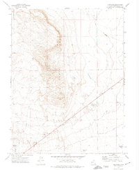
1972 · Long Ridge
USGS Topo · 1:24,000