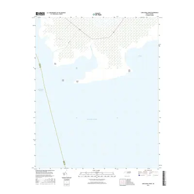
2016 Map of Long Shoal Point
USGS Topo · Published 2016About this map
The coastal marshlands and low-lying points of eastern North Carolina define this maritime landscape where the waters of Pains Bay and Parched Corn Bay meet the sound. The terrain is marked by a complex network of wetlands and tidal inlets, including Muddy Cr and Pains Creek, which carve into the shoreline near Pains Point. This environment has historically dictated the movement of goods and people, with Pamlico Rd serving as the primary corridor through the saturated interior. Local geography is shaped by small landforms such as Rawls Island and Rawls Point, which sit at the edge of the open Atlantic Ocean. The boundary between Hyde Co and Dare Co runs through these waters, illustrating how the political divisions of the Outer Banks region follow the natural contours of its bays and shoals.
Find a feature on this map
11 named features on this map. Tap any name to fly to it.
Don’t see what you’re looking for? This feature index may not catch every label — zoom into the map to look around manually.
Map Details
Editions of this 2016 Long Shoal Point Map
This is the sole edition of this map. No revisions or reprints were ever made.
Other maps of this area

1943 · Roanoke Island
USGS Topo · 1:125,000

1951 · Middletown Anchorage
USGS Topo · 1:24,000

1951 · Long Shoal Point
USGS Topo · 1:24,000

1951 · Engelhard East
USGS Topo · 1:24,000

1953 · Engelhard NW
USGS Topo · 1:24,000

1953 · Stumpy Point
USGS Topo · 1:24,000

1953 · Engelhard NE
USGS Topo · 1:24,000

1955 · Wanchese
USGS Topo · 1:250,000

1957 · Manteo
USGS Topo · 1:250,000

1960 · Manteo
USGS Topo · 1:250,000