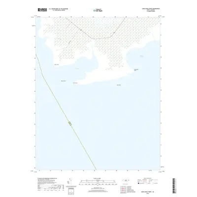
2019 Map of Long Shoal Point
USGS Topo · Published 2019About this map
The coastal wetlands and estuarine environment of the Albemarle-Pamlico Sound system dominate this landscape, where the boundary between Dare and Hyde counties meets in the open water. The map detail highlights a series of prominent maritime features including Long Shoal Point, Pains Point, and Rawls Point, which define the intricate shoreline of Pains Bay and Parched Corn Bay. Inland, the terrain is largely defined by marshy expanses drained by Muddy Cr. The only significant terrestrial infrastructure shown is Pamlico Rd, which cuts through the wetland towards the sound. This sheet serves as a clear record of the low-lying geography of the North Carolina coast, capturing the relationship between the sheltered bays and the expansive Long Shoal area during the late 2010s.
Find a feature on this map
10 named features on this map. Tap any name to fly to it.
Don’t see what you’re looking for? This feature index may not catch every label — zoom into the map to look around manually.
Map Details
Editions of this 2019 Long Shoal Point Map
This is the sole edition of this map. No revisions or reprints were ever made.
Other maps of this area

1943 · Roanoke Island
USGS Topo · 1:125,000

1951 · Middletown Anchorage
USGS Topo · 1:24,000

1951 · Long Shoal Point
USGS Topo · 1:24,000

1951 · Engelhard East
USGS Topo · 1:24,000

1953 · Engelhard NW
USGS Topo · 1:24,000

1953 · Stumpy Point
USGS Topo · 1:24,000

1953 · Engelhard NE
USGS Topo · 1:24,000

1955 · Wanchese
USGS Topo · 1:250,000

1957 · Manteo
USGS Topo · 1:250,000

1960 · Manteo
USGS Topo · 1:250,000