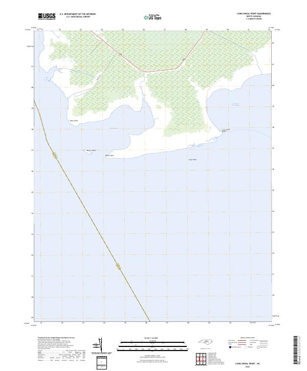
2022 Map of Long Shoal Point
USGS Topo · Published 2022About this map
Coastal wetlands and expansive sounds dominate this 2022 survey of the North Carolina shoreline, where the boundary between Dare and Hyde counties runs through the waters of Pains Bay. The landscape is defined by its indented coastline, featuring distinctive landforms such as Long Shoal Point and Pains Point. Navigation and geography in this area are oriented around the shallow waters of Long Shoal and the protected inlets of Parched Corn Bay. Inland, the terrain is largely inaccessible marshland, pierced only by Highway 264 and the historical alignment of Pamlico Rd. Local identifiers like Rawls Island and Rawls Point reflect the enduring family names associated with these remote coastal reaches. The map illustrates a fragile environment where narrow waterways like Muddy Cr and Pains Creek thread through a landscape primarily shaped by the tides.
Find a feature on this map
12 named features on this map. Tap any name to fly to it.
Don’t see what you’re looking for? This feature index may not catch every label — zoom into the map to look around manually.
Map Details
Editions of this 2022 Long Shoal Point Map
This is the sole edition of this map. No revisions or reprints were ever made.
Other maps of this area

1943 · Roanoke Island
USGS Topo · 1:125,000

1951 · Middletown Anchorage
USGS Topo · 1:24,000

1951 · Long Shoal Point
USGS Topo · 1:24,000

1951 · Engelhard East
USGS Topo · 1:24,000

1953 · Engelhard NW
USGS Topo · 1:24,000

1953 · Stumpy Point
USGS Topo · 1:24,000

1953 · Engelhard NE
USGS Topo · 1:24,000

1955 · Wanchese
USGS Topo · 1:250,000

1957 · Manteo
USGS Topo · 1:250,000

1960 · Manteo
USGS Topo · 1:250,000