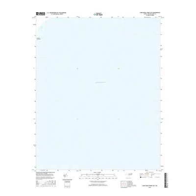
2016 Map of Long Shoal Point OE E
USGS Topo · Published 2016About this map
Parched Corn Point and the waters of Sandy Bay define the northwestern corner of this coastal survey, where the terrestrial edge of Dare County meets the expanse of the Atlantic Ocean. This map documents a transitional aquatic landscape dominated by open water and shoals, capturing the fragile shoreline of the Outer Banks region as it existed in 2016. The presence of these specific coastal landmarks provides a precise reference point for tracking shoreline changes and the movement of coastal sediments in a geography defined by the relentless meeting of land and sea.
Find a feature on this map
3 named features on this map. Tap any name to fly to it.
Don’t see what you’re looking for? This feature index may not catch every label — zoom into the map to look around manually.
Map Details
Editions of this 2016 Long Shoal Point OE E Map
This is the sole edition of this map. No revisions or reprints were ever made.
Other maps of this area

1943 · Roanoke Island
USGS Topo · 1:125,000

1951 · Long Shoal Point
USGS Topo · 1:24,000

1953 · Stumpy Point
USGS Topo · 1:24,000

1953 · Engelhard NE
USGS Topo · 1:24,000

1955 · Wanchese
USGS Topo · 1:250,000

1957 · Manteo
USGS Topo · 1:250,000

1960 · Manteo
USGS Topo · 1:250,000

1985 · Cape Hatteras
USGS Topo · 1:100,000

1985 · Manteo
USGS Topo · 1:100,000
2000 · Engelhard NE
USGS Topo · 1:24,000