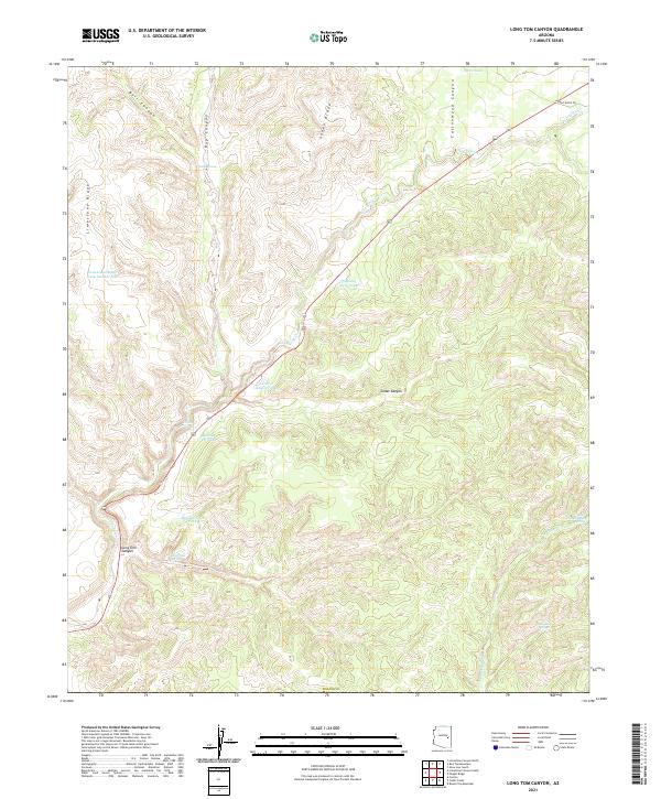
2021 Map of Long Tom Canyon
USGS Topo · Published 2021About this map
Limestone Ridge and Snake Ridge define the high ground of this Arizona landscape, which is marked by a complex network of seasonal water sources and deep drainage systems. The presence of numerous livestock tanks, such as Horse Tank, Dove Tank, and Bull Pasture Tank, points to the long-standing ranching heritage of Navajo Co. Local geography is shaped by the descent into Long Tom Canyon and Cottonwood Canyon, where reliable water points like Little Spring and Dripping Spring were essential for early movement through the region. In the northeast, the intersection of Faught Ridge Rd and the drainage of Forestdale Cr illustrates the sparse but vital infrastructure connecting these uplands.
Find a feature on this map
33 named features on this map. Tap any name to fly to it.
Don’t see what you’re looking for? This feature index may not catch every label — zoom into the map to look around manually.
Map Details
Editions of this 2021 Long Tom Canyon Map
This is the sole edition of this map. No revisions or reprints were ever made.
Other maps of this area

1886 · Holbrook
USGS Topo · 1:250,000

1893 · Holbrook
USGS Topo · 1:250,000

1954 · Holbrook
USGS Topo · 1:250,000

1954 · Mesa
USGS Topo · 1:250,000

1957 · Mesa
USGS Topo · 1:250,000

1957 · Holbrook
USGS Topo · 1:250,000

1958 · Mesa
USGS Topo · 1:250,000

1958 · Holbrook
USGS Topo · 1:250,000

1960 · Holbrook
USGS Topo · 1:250,000

1960 · Mesa
USGS Topo · 1:250,000