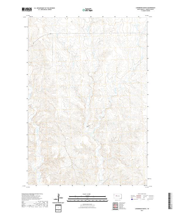
2021 Map of Longbrake Ranch
USGS Topo · Published 2021About this map
Longbrake Ranch stands as a central landmark in this portion of Ziebach County, positioned amidst a network of prairie drainages. The landscape is defined by the convergence of several waterways, including the W Br Ash Cr and E Br Ash Cr, which feed into the primary Ash Cr. To the west, the winding path of Rattlesnake Cr and the smaller Girl Cr illustrate the natural runoff patterns of this Dakota rangeland. Human influence on the hydrology is visible through the placement of Herren Dam in the northern reaches, a vital feature for water management in this arid environment. The map provides a look at the modern rural layout of this region, emphasizing the relationship between cattle ranching and the seasonal water sources that sustain it.
Find a feature on this map
13 named features on this map. Tap any name to fly to it.
Don’t see what you’re looking for? This feature index may not catch every label — zoom into the map to look around manually.
Map Details
Editions of this 2021 Longbrake Ranch Map
This is the sole edition of this map. No revisions or reprints were ever made.
Other maps of this area

1954 · Pierre
USGS Topo · 1:250,000

1955 · Rattlesnake Lake
USGS Topo · 1:24,000

1955 · Rattlesnake Lake NE
USGS Topo · 1:24,000

1958 · Pierre
USGS Topo · 1:250,000

1982 · Bull Creek 2 NE
USGS Topo · 1:24,000

1982 · Bridger NE
USGS Topo · 1:24,000

1982 · Red Scaffold
USGS Topo · 1:24,000

1982 · Miller Dam
USGS Topo · 1:24,000

1982 · Longbrake Ranch
USGS Topo · 1:24,000
1982 · Diermier Ranch
USGS Topo · 1:24,000