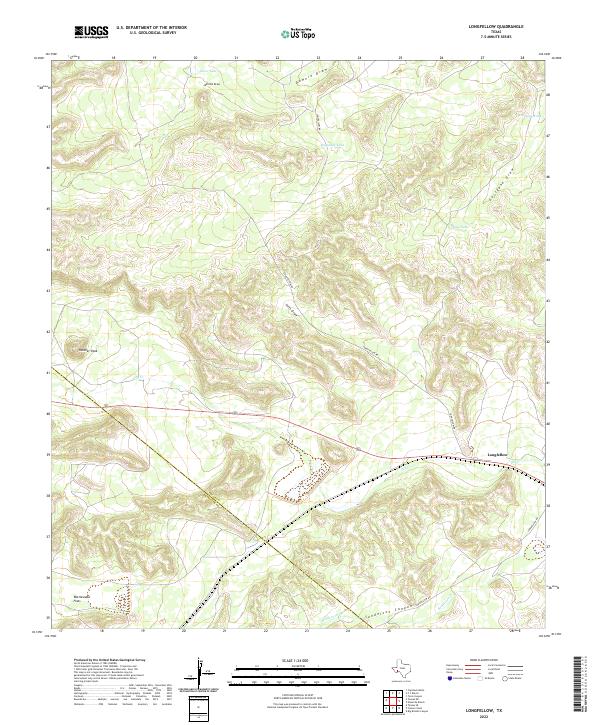
2022 Map of Longfellow
USGS Topo · Published 2022About this map
Longfellow sits in a high-desert landscape where the border between Pecos and Brewster Counties cuts through the West Texas brush. The terrain is defined by a complex network of seasonal drainages, including Downie Draw, Javelina Draw, and Fortyone Draw, which funnel toward Sanderson Canyon to the south. Scattered livestock tanks such as Haystack Tank and Gap Tank emphasize the arid ranching character of the region. Distinctive landmarks like Panther Peak and the expanse of Rattlesnake Flats provide orientation in this sparsely populated area. The presence of Longfellow Rd following the lower elevations near Dry Cr suggests the enduring importance of this remote transit corridor for local ranching operations and regional connectivity.
Find a feature on this map
15 named features on this map. Tap any name to fly to it.
Don’t see what you’re looking for? This feature index may not catch every label — zoom into the map to look around manually.
Map Details
Editions of this 2022 Longfellow Map
This is the sole edition of this map. No revisions or reprints were ever made.
Other maps of this area

1920 · Longfellow
USGS Topo · 1:125,000

1954 · Fort Stockton
USGS Topo · 1:250,000

1958 · Fort Stockton
USGS Topo · 1:250,000

1968 · Cap Rock Butte
USGS Topo · 1:24,000

1968 · Big Brindle Canyon
USGS Topo · 1:24,000

1968 · Toms Canyon
USGS Topo · 1:24,000

1968 · F C Ranch
USGS Topo · 1:24,000

1968 · Fresno Creek
USGS Topo · 1:24,000

1968 · Longfellow
USGS Topo · 1:24,000
1968 · Tesnus SE
USGS Topo · 1:24,000