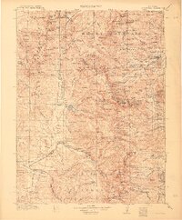
1915 Map of Longs Peak
USGS Topo · Published 1915About this map
Longs Peak and the surrounding high country of the Front Range appear here just as the region transitioned from a mining and ranching frontier to a premier mountain destination. The 1912-1913 survey work by C.A. Ecklund and B.A. Jenkins documents the early development of Estes Park and Grand Lake before the full impact of modern tourism infrastructure. High-altitude outposts like Monarch P O and the Sleepy Hollow School reflect the sparse but established settlement patterns of the era. The map details the complex glacial topography and water systems including the Cache la Poudre River, Fall River, and Big Thompson River. Strategic mountain crossings such as Arapaho Pass and Buchanan Pass are clearly marked, alongside the historic Ute Trail. The intersection of Arapaho National Forest, Rocky Mountain National Park, and Colorado National Forest underscores the emerging federal management of these public lands during the early 20th century.
Find a feature on this map
168 named features on this map. Tap any name to fly to it.
Don’t see what you’re looking for? This feature index may not catch every label — zoom into the map to look around manually.
Map Details
Editions of this 1915 Longs Peak Map
3 editions found

Other maps of this area

1899 · West Denver
USGS Topo · 1:125,000

1902 · Boulder
USGS Topo · 1:62,500

1904 · Boulder
USGS Topo · 1:62,500

1905 · Central City
USGS Topo · 1:62,500

1905 · Mount Olympus
USGS Topo · 1:62,500

1906 · Blackhawk
USGS Topo · 1:62,500

1907 · Mount Olympus
USGS Topo · 1:62,500

1907 · Livermore
USGS Topo · 1:125,000

1909 · Livermore
USGS Topo · 1:125,000

1910 · Central City
USGS Topo · 1:62,500