
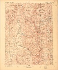
1915 Map of Longs Peak
USGS Topo · Published 1915About this map
Estes Park and Grand Lake serve as the primary gateways to this high-altitude landscape during the early years of the National Park era. Following surveys in 1912 and 1913, this map captures the region just as Rocky Mountain National Park was being established. The terrain is defined by its massive glacial features, including Sprague Glacier, Tyndall Glacier, and Andrews Glacier, which feed into a complex network of alpine waters like The Loch and Chasm Lake.
Find a feature on this map
241 named features on this map. Tap any name to fly to it.
Don’t see what you’re looking for? This feature index may not catch every label — zoom into the map to look around manually.
Map Details
Editions of this 1915 Longs Peak Map
3 editions found
Other maps of this area

1899 · West Denver
USGS Topo · 1:125,000

1902 · Boulder
USGS Topo · 1:62,500

1904 · Boulder
USGS Topo · 1:62,500

1905 · Central City
USGS Topo · 1:62,500

1905 · Mount Olympus
USGS Topo · 1:62,500

1906 · Blackhawk
USGS Topo · 1:62,500

1907 · Mount Olympus
USGS Topo · 1:62,500

1907 · Livermore
USGS Topo · 1:125,000

1909 · Livermore
USGS Topo · 1:125,000

1910 · Central City
USGS Topo · 1:62,500