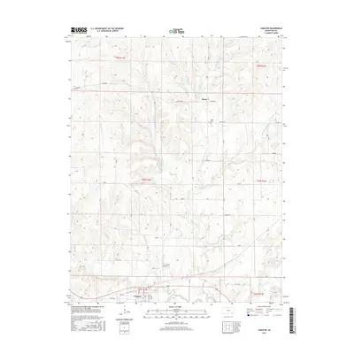
2015 Map of Longton
USGS Topo · Published 2015About this map
The Elk River flows across the southern reaches of this Elk County landscape, anchoring the settlement of Longton. This portion of southeastern Kansas is defined by its watershed, where the dendritic patterns of Painterhood Cr and its various branches, including W Painterhood Cr and Mid Painterhood Cr, carve through the terrain. The map captures the agricultural and rural character of the region, marked by a systematic grid of roads like Limestone Rd and Killdeer Rd. For those researching local heritage, the Longton Cem and the smaller Busby Cem near the locality of Busby provide important genealogical touchpoints. The naming of roads such as Flint Rd and labels like Limestone and Flint reflect the underlying geology that has shaped the area's land use and local identity.
Find a feature on this map
36 named features on this map. Tap any name to fly to it.
Don’t see what you’re looking for? This feature index may not catch every label — zoom into the map to look around manually.
Map Details
Editions of this 2015 Longton Map
This is the sole edition of this map. No revisions or reprints were ever made.
Other maps of this area

1885 · Eureka
USGS Topo · 1:125,000

1885 · Sedan
USGS Topo · 1:125,000

1886 · Fredonia
USGS Topo · 1:125,000

1886 · Independence
USGS Topo · 1:125,000

1888 · Eureka
USGS Topo · 1:125,000

1889 · Sedan
USGS Topo · 1:125,000

1894 · Fredonia
USGS Topo · 1:125,000

1894 · Independence
USGS Topo · 1:125,000

1894 · Eureka
USGS Topo · 1:125,000

1905 · Independence
USGS Topo · 1:125,000