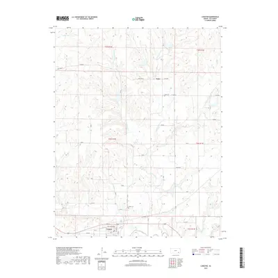
2018 Map of Longton
USGS Topo · Published 2018About this map
Longton serves as the primary hub in this corner of Elk County, situated just north of the Elk River where several creek systems converge. The landscape is defined by the branching network of Painterhood Cr, including its west, middle, and east forks, which carve through the terrain alongside Little Hitchen Cr. These waterways historically dictated the placement of small rural outposts and family burial grounds, such as Busby Cem near the settlement of Busby and Longton Cem just north of the main townsite. The map details a strictly organized grid of rural roads with names like Limestone Rd and Killdeer Rd that connect smaller named points including Junebug, Hawk, and Grain. This 2018 survey captures the modern road network and hydrologic features that have shaped the agricultural and social geography of south-central Kansas for generations.
Find a feature on this map
31 named features on this map. Tap any name to fly to it.
Don’t see what you’re looking for? This feature index may not catch every label — zoom into the map to look around manually.
Map Details
Editions of this 2018 Longton Map
This is the sole edition of this map. No revisions or reprints were ever made.
Other maps of this area

1885 · Eureka
USGS Topo · 1:125,000

1885 · Sedan
USGS Topo · 1:125,000

1886 · Fredonia
USGS Topo · 1:125,000

1886 · Independence
USGS Topo · 1:125,000

1888 · Eureka
USGS Topo · 1:125,000

1889 · Sedan
USGS Topo · 1:125,000

1894 · Fredonia
USGS Topo · 1:125,000

1894 · Independence
USGS Topo · 1:125,000

1894 · Eureka
USGS Topo · 1:125,000

1905 · Independence
USGS Topo · 1:125,000